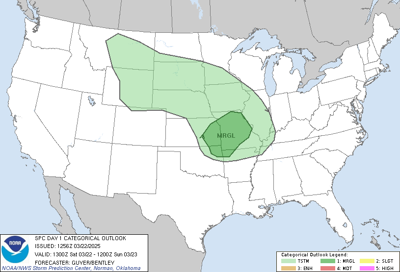
The Storm Prediction Center has issued a Slight risk of Severe Weather today over parts of lower Michigan and surrounding areas, and then farther south across portions of Mississippi, Alabama, and Tennessee. as a weakening upper-level low moves across Lake Superior and into Canada this afternoon. At this time, isolated strong thunderstorms exist across south-central Louisiana, and farther east across the Florida Panhandle as a weak boundary and associated upper impulse moves across the Gulf of Mexico. These storms occasionally exhibit weak rotation, but insufficient parameters will prevent a high tornado threat. Regardless, isolated brief/weak tornadoes are possible, along with damaging wind gusts.
Mesoscale Discussion #247 states that a weather watch is not likely across this area, but convective trend will be monitored.
 |
| Current radar imagery across Louisiana and the Florida Panhandle |
The main threat for Severe Thunderstorms will arrive this afternoon as daytime heating, combined with maximum forcing come together. Storm Prediction Center Mesoscale Analysis reveals approximately 100 j/kg of MUCAPE along with Effective Bulk Shear near 30 kts associated with an intensifying line of thundershowers across northern Illinois. As the weakening upper-level low moves northeastward, expect this line to progress east and east-northeast with the possibility of producing damaging winds and an isolated tornado. As we head into this afternoon, expect isolated supercells to fire across northern Indiana and lower Michigan. The threat will end later on tonight as main forcing moves away.
 |
| Storm Prediction Center Day 1 Categorical Outlook |

